The US Supreme Court ruled that cities can take property under "eminent domain" and repurpose said land for "public purposes" that include transferring the property to other private uses.
The public is outraged, as they should be. One poll found over 90% of citizens object. As Jay Leno observed, when was the last time over 90% of the American populace agreed on something?
A poster to Dave Farber's list pointed out that media has done a poor job of covering the recent Supreme Court decision. News coverage focuses on the decision and the reaction to it, not the underlying facts of the case and legal arguments.
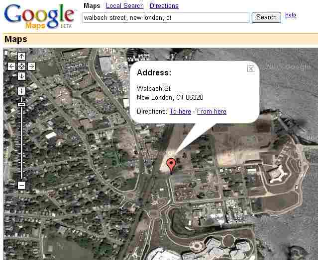
The block in question is a depressed area in New London, Connecticut. Google Maps offers a satellite view of the area in question.
This is an important advance: if the major media won't give you the background facts, maybe Google will lead you to authoritative information. Imagine when Google links in other background information:
- Much more detailed satellite mages, at the building level.
- The property tax records for the properties to be seized.
- The last sale prices for those properties, and records for similar parcels in the neighborhood.
- Census demographics for the area.
- Direct links to all the briefs filed in the case, on both sides, including amicus briefs.
- Full text of all relevant court decisions.
- Links, a la Westlaw or Lexis, to previous relevant decisions on eminent domain.
It's not a question of whether Google will link in these kinds of details -- it's when. And then the question is whether a public trained on sound bites and self-serving news releases and 24 hour news channels will ever bother to check the facts and the details.
You might want to check out the sateillte view of the New London neighborhood the Supreme Court decision covers for yourself.
No comments:
Post a Comment